Water flows across boundaries. Authority does not.
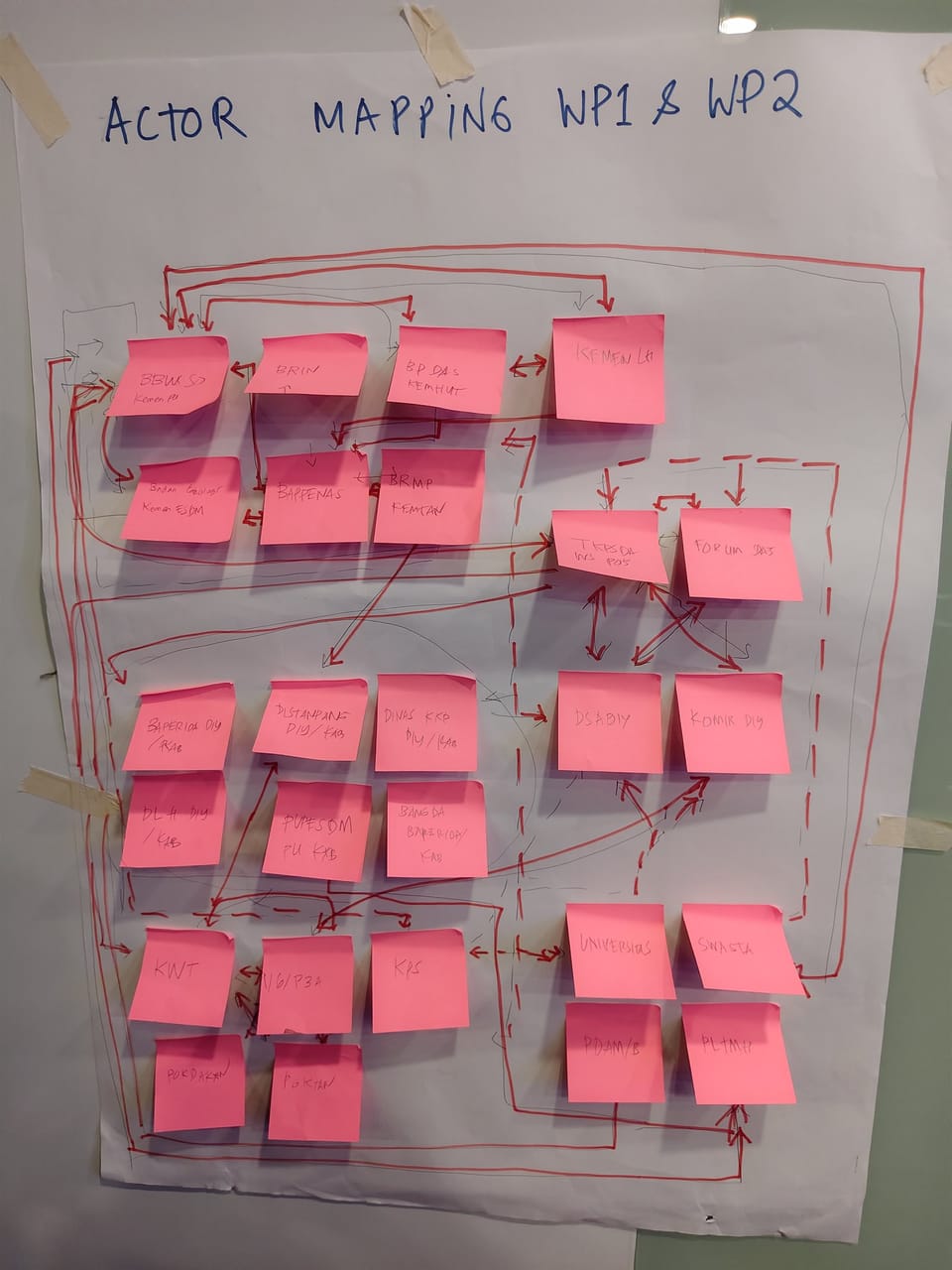
One of the more candid moments of the workshop came when a participant described the country's water-authority architecture, with a small, tired smile, as a labyrinth. The line drew nods around the table — not because the sentiment was novel, but because every institution in the room had hit the wall at least once. Water flows across administrative borders. Authority does not.
The mapping is not difficult to draw on a slide. It is difficult to live with. The Ministry of Energy and Mineral Resources, through its Geological Agency, handles groundwater and grants extraction concessions. The Ministry of Environment handles inland water ecosystems through, among other directorates, its Directorate for Protection and Use of Inland Water Ecosystems. The Ministry of Public Works handles irrigation and water-resource infrastructure. The river-basin authorities (BBWS) are vertical central-government institutions that operate at the basin level. Provinces — through Bappeda and provincial PUPR offices — hold planning and implementation responsibilities. District and city governments issue smaller-scale permits.
A further structural shift is in motion: the consolidation of 128 river-basin territories to 124, with sixty-four of them moving to direct central authority. WS Serayu Bogowonto, with its National Strategic status, and WS Progo Opak Serang, with its cross-province status, are likely both to fall within the central-authority sixty-four — but the precise criteria and the implications for sub-national planning still await formal clarification.
"There's no certainty on the division of authority." — paraphrased, sub-national government participant
The participants' ask of the project was specific. The water-accounting framework that the consortium produces should not assume away the authority question. It should map who does what, in writing, for the Serayu-Opak basin: which agency issues which permit, which dataset belongs to which institution, which decision sits at which level. If the framework sits silent on these questions, the data and the decisions will collide — and the project's technical recommendations will be invisible to the agencies that need to act on them.
This carries an additional implication for timing. Both DI Yogyakarta's RPJMD (ending 2027) and Central Java's RPJMD are in active drafting cycles, and several participants asked the project to land its recommendations in time to enter those documents. Too early, and the recommendations are not yet supported by fieldwork. Too late, and they wait an entire cycle for another window.