Three different clocks: the quiet politics of water data
If one moment in the workshop captured a recurring frustration of Indonesia's water sector, it was the head-shake from the Central Java PUPR delegation when the discussion turned to data synchronisation. The frustration is hard to dramatise because the cause is mundane: three institutions that need to sit at the same table to discuss water allocation are working from three different baselines.
BBWS Serayu-Opak follows its own reference year, set by the basin authority's RPSDA cycle. DI Yogyakarta's medium-term development plan, the RPJMD, runs 2022–2027, ending in 2027. Central Java's RPJMD runs on a different cycle — Central Java has just completed a cycle, while DI Yogyakarta is still mid-cycle. Three institutions, three calendars. As one participant put it: data synchronisation is hard because the baselines start in different years; three things have to be aligned at once.
"Data synchronisation is hard. The baselines start from different years. Three of them have to be aligned." — paraphrased, Central Java PUPR participant
The practical consequence is that water-allocation or water-availability numbers in Report A almost never match Report B. Policy decisions are then made on data that is already lagging by the time it is used. The discussion produced a candidate solution that drew nods around the table: 2030 as a more neutral reference year. It aligns with the SDG horizon, sits beyond all current RPJMDs, and gives DI Yogyakarta and Central Java a common point at which to meet in the middle.
The same conversation surfaced an idea that has been raised in basin forums before but rarely resourced: an open-data dashboard. The point of the dashboard, as several participants framed it, is not technological dazzle. It is the operational dignity of having one place where every party — BBWS, dinas, Bappeda, ministry, academic — can see the same numbers, on the same day, computed from the same inputs.
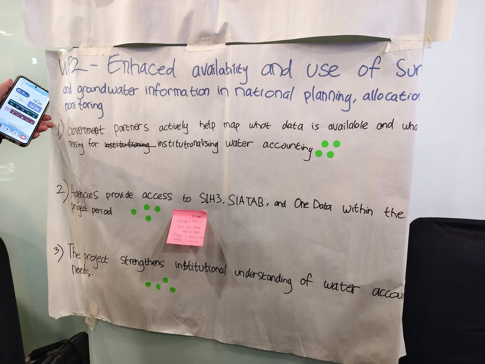
The technical complications were acknowledged honestly. Indonesia already has overlapping information systems. SIH3 (Hydrology, Hydrometeorology and Hydrogeology Information System) lives at the Ministry of Public Works. SIATAB (the Groundwater and Raw Water Information System) lives in a different directorate. Satu Data Indonesia sits above them as a national framework. Inside the irrigation system, access codes are split by area and tier — central, regional, district — and only the operations and maintenance directorate has cross-area access, with separate codes per area. The longer-term aspiration that several participants stated bluntly was the simplest version: try to include everything in one.
The harder step is the human one. Sub-national participants pointed out that data sharing is rarely blocked by technology and almost always blocked by ambiguity over institutional authority. Whose data is it? Who certifies the version of record? Who pays for the upkeep? These questions sit underneath every dashboard conversation in the country and they will sit underneath the project's. The project has committed to a stakeholder map with explicit information flows and approval gates — not as documentation for its own sake, but as a way to give every agency a clear answer to the question that comes before any data exchange: what am I allowed to share with whom, and with what consequences?